Trail Running at the Nockberge-Trail
Stage 01
from the Katschberghöhe to the Neuen Bonner-Hütte
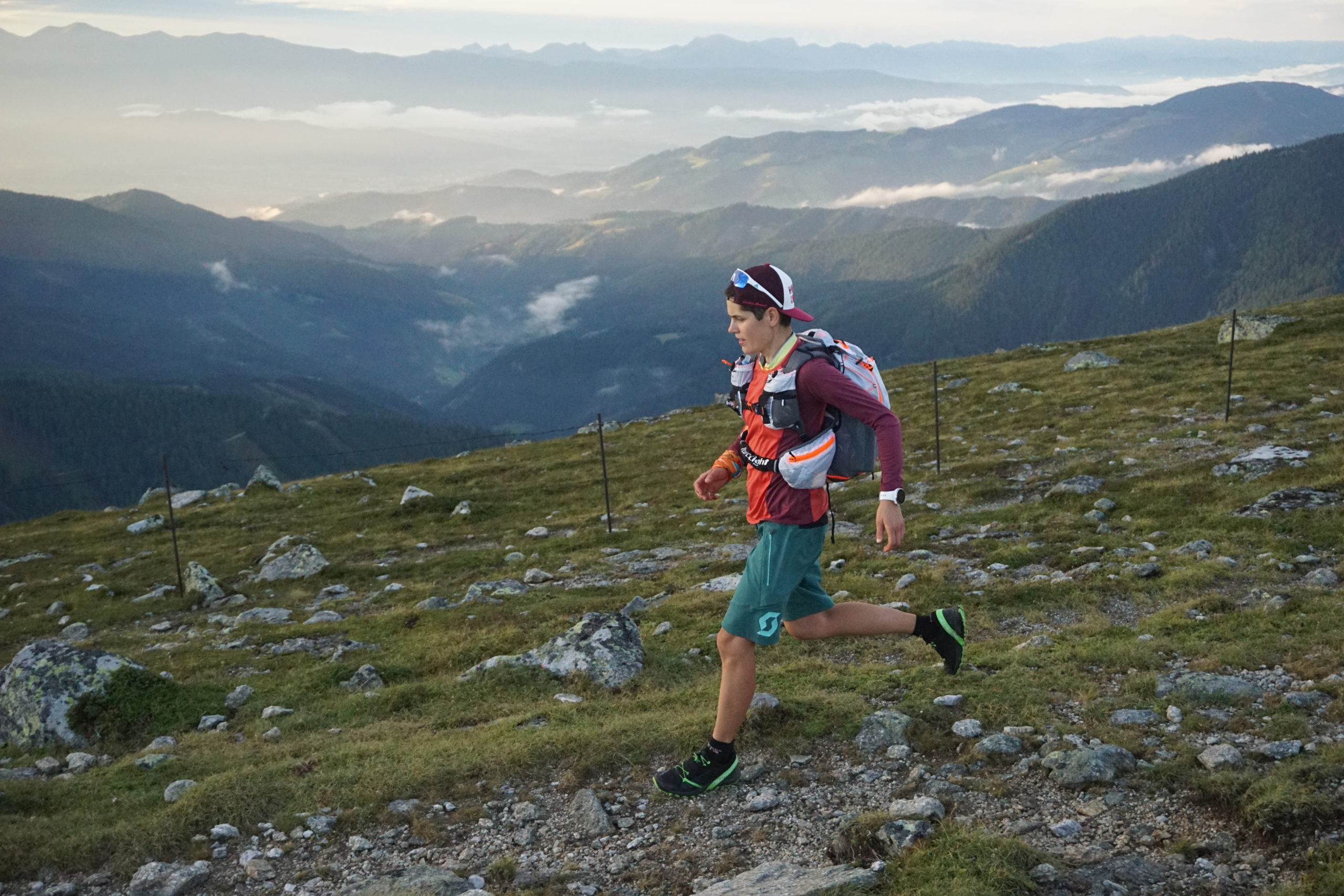
Smooth start: over the ridge between Aineck and Theuerlnock down to the romantic Neue Bonner Hütte
The starting point of the Nockberge-Trail is the valley station Aineck on the Katschberghöhe. Here you choose the well-constructed path no. 111 – the so-called highway – along the slope to the summit of Aineck (during the summer season you can also use the Aineck gondola). From here, at the latest, it becomes quieter and quieter: you leave the ski area and continue on path no. 111 over the wide and panoramic ridge to the south to the Theuerlnock. From Theuerlnock you hike along trail no. 111 over alpine pastures and later through woods to the Neue Bonner-Hütte. A short stage – ideal to put your legs up on the sunny terrace of the rustic hut, to get rid of everyday stress and simply experience the landscape and culinary delights.
Difficulty: medium
Length: 8,0 km
Ascent: 591 Hm
Descent: 519 Hm
Trailrunning at the Nockberge-Trail © www.trailrunning-szene.at
Stage 02
from the Neuen Bonner-Hütte to the Turracher Höhe
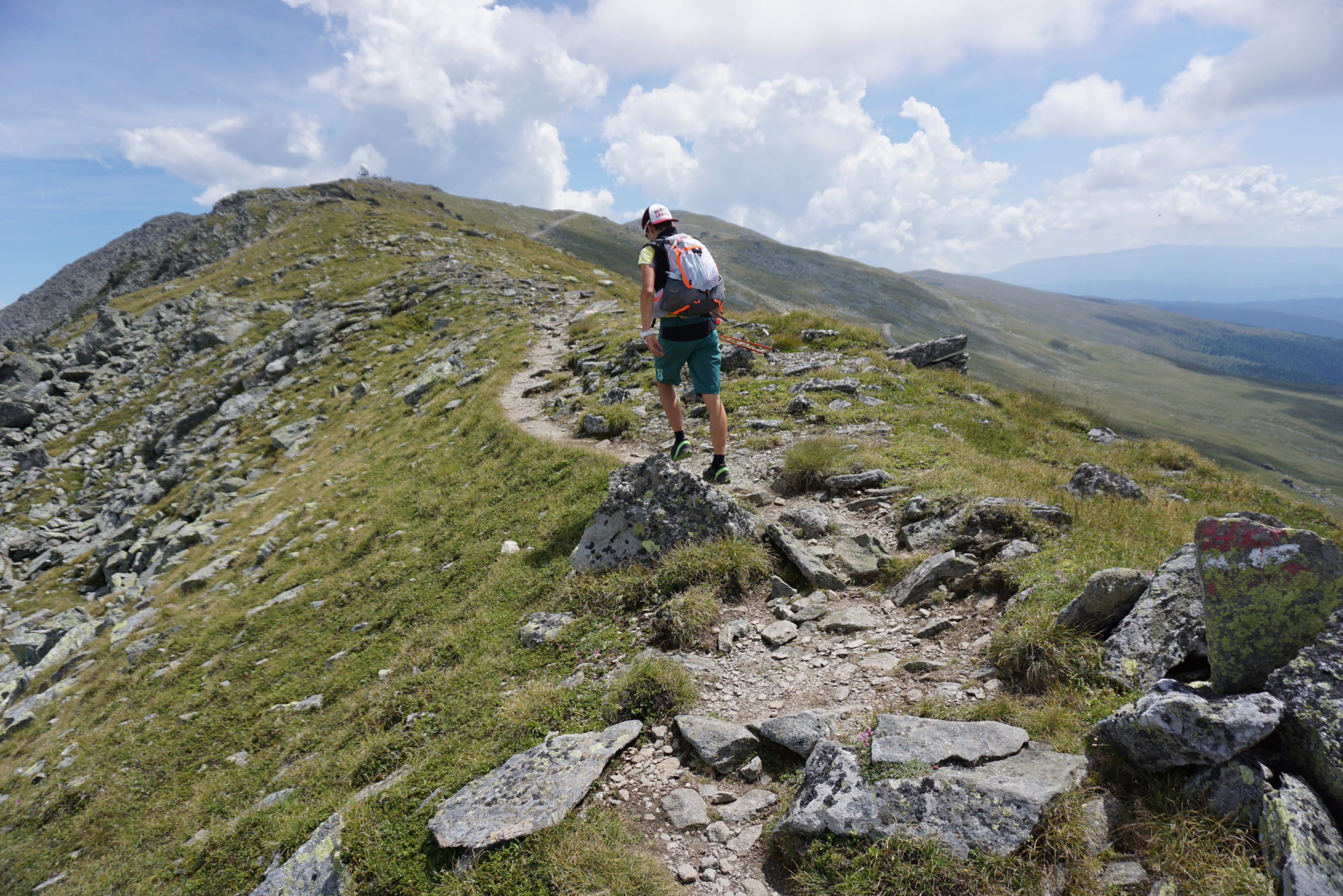
The “royal” stage: Over many soft peaks, along panoramic summit crests and past small mountain lakes in a somewhat scandinavian landscape to Turracher Höhe.
From the Neue Bonner Hütte you first follow the wide road slightly downhill, which only leads east towards Rennweg in the Laußnitztal valley. After about 800m you come to a turn-off. Here you keep going towards Ebenwald-Laußnitzer Hütte: first you take the forest path no. 113 up to Ebenwaldhöhe. At the junction you stay on your way and walk straight ahead first downhill and then a little steeper uphill to the rustic Laußnitzer Hütte. From here the trail no. 113 leads up to the idyllic Laußnitzsee, which you follow along its eastern shore. Now it goes a bit steeper uphill and then gently ascending (at the junction to the left) to the Schwarzwand (2214m).
Now you run more or less along the wonderful ridges (always following trail no. 113) just below the Gmeinnock (2.130m) past the nameless mountain lakes to the beautifully situated lake Anderlesee. Continue over the Kameritzhöhe (2.167m) to the Gaipahöhe (2.192m). Here you leave the ridge and walk down the Wiesensteig for about 180m until you reach a road. Follow that road to the left (east) almost without loss of altitude until you reach the “Blutigen Alm Hütte” (1.195m). Here you have the opportunity to inform yourself about the Speik, a small inconspicuous plant which, in fact, only occurs in the Nockberge mountains.
At the hut, choose trail no. 114 down south, past a reservoir, always along the marked hiking trail. It leads westward of the gondola to Innerkrems.
In Innerkrems you choose path no. 4 eastwards along the beautiful Donnerschlucht gorge to the beginning of the Schönfeld just before the Dr. Josef-Mehrl-Hütte: To get to the start of the path you follow the road eastwards past the hotels Frühauf and Berghof until a small road with path mark no. 4 branches off to the left.
Shortly before the Dr. Josef-Mehrl-Hütte you do not turn north into the Schönfeld, but choose the gravel road (path no. 126) following the stream Kremsbach to the south; this turns into a path and leads through the scenic valley floor of the Rosaninalm gently uphill. Remarkable is the strongly meandering river Kremsbach, whose winding stream bed results from the very low gradient. A little later the path moves away from the stream and the terrain becomes steeper. Passing an ecologically valuable marshland, you reach the slandering Rosanin Lake at 2.057m above sea level, which is surrounded to the southeast. From the lake you go in serpentines up to the crest of the north-western foothills of the Großer Königstuhl, where you meet trail no. 125. Follow this to the left until you reach the summit of the Großen Königstuhl (2.336m), one of the most famous mountains of the Nockberge.
The following section of the trail highlights the vastness of the Nockberge mountains particularly well: from Königstuhl take trail no. 125 over the mountain ridge to the slightly lower Karlnock. On the other side you descend a few meters and now leave the ridge: You cross the Stangboden to the west below the Stangnock until you reach the Stangscharte. Now continue along path no. 123 (later no. 126) below Gregerlnock via Schneegrubensattel to Pregatscharte. Now you cross over path no. 126 north of the Simmerleck until you reach a crossing at 1.969m above sea level.
Here you choose path no. 126 down to the Winkleralm. Continue without height gain or loss over the Schafalm and after a short ascent over the Steinturrach down to the Turracher Höhe and the beautiful lake Turrachsee.
Difficulty: medium
Length: 37,9 km
Ascent: 1.880 Hm
Decent: 1.814 Hm
Trailrunning at the Nockberge-Trail © www.trailrunning-szene.at
Stage 03
From the Turracher Höhe to Bad Kleinkirchheim
Trail Running in the heart of the Nockberge mountains: peak after peak through alpine pastures and over summit ridges from Turrachsee to Bad Kleinkirchheim
The starting point of the last stage is at the bottom station of the Nocky-Flitzer, a summer toboggan run with lift at Turracher Höhe. From here you follow the Barbara path to the southwest: First you climb through forest to an avalanche barrier and then into a long side valley, the so-called Kormulde. Here you choose the right path, which will soon lead you to the old mine – where in the past cinnabar was mined. Now you go on until you reach the ridge, which goes down from the Rinsennock to the southeast and reach the peak of the Rinsennock via path no. 149 – the highest point of today (2.334m) is reached early in the day. From there, you have another wonderful view of lake Turrachsee.
From Rinsennock you descend to the west until you reach the path of yesterday’s stage. The next section (path no. 126) is identical to yesterday’s stage, except that you take the path in the opposite direction: first you reach the Pregatscharte. Here you follow yesterday’s path no. 126 in the direction of Gr. Königstuhl/Prießhütte (Salzsteigweg) for another good half an hour until a path branches off to the left in the direction of Prießhütte. Now follow this path (path no. 123) in an arc through the kar under the Koflernock to the Prießhütte, where you can take a short break.
After this little rest you continue uphill along the Nockalm Road, which can be very busy with cars and motorcycles. But don’t worry, this section is not long: after a few hairpin bends (about 2 km; 35 min hiking time), path no. 123 or 3 branches off in a right-hand bend. This first leads to the Auernighütte and then steeply uphill to the Flache Scharte.
Here begins the wonderful ridge over the Klomnock, with 2.331 m above sea level only slightly lower than the highest peak of today, the Rinsennock: First over the ridge (path no. 161 or 1) to the west over the Steinhöhe to the summit of the Klomnock. On the other side continue west over the so-called “Soldier’s Cross/Soldatenkreuz” to the 2.226 m high Mallnock, the last peak of your Trailrun through the Nockberge mountains. Still following trail no. 161 or 1, mostly along the ridge turning here to the southwest, you walk the last section to the mountain station of the Brunnachalm Biosphere Park lift on the Brunnachhöhe. Now you can either walk along the slope under the gondola or take the gondola down to the valley station, where the shuttle to your hotel in Bad Kleinkirchheim awaits you.
Difficulty: medium
Length: 20,6 km (23.6 km without lift)
Ascent: 1.359 Hm
Descent: 1.226 m (1.809m without lift)
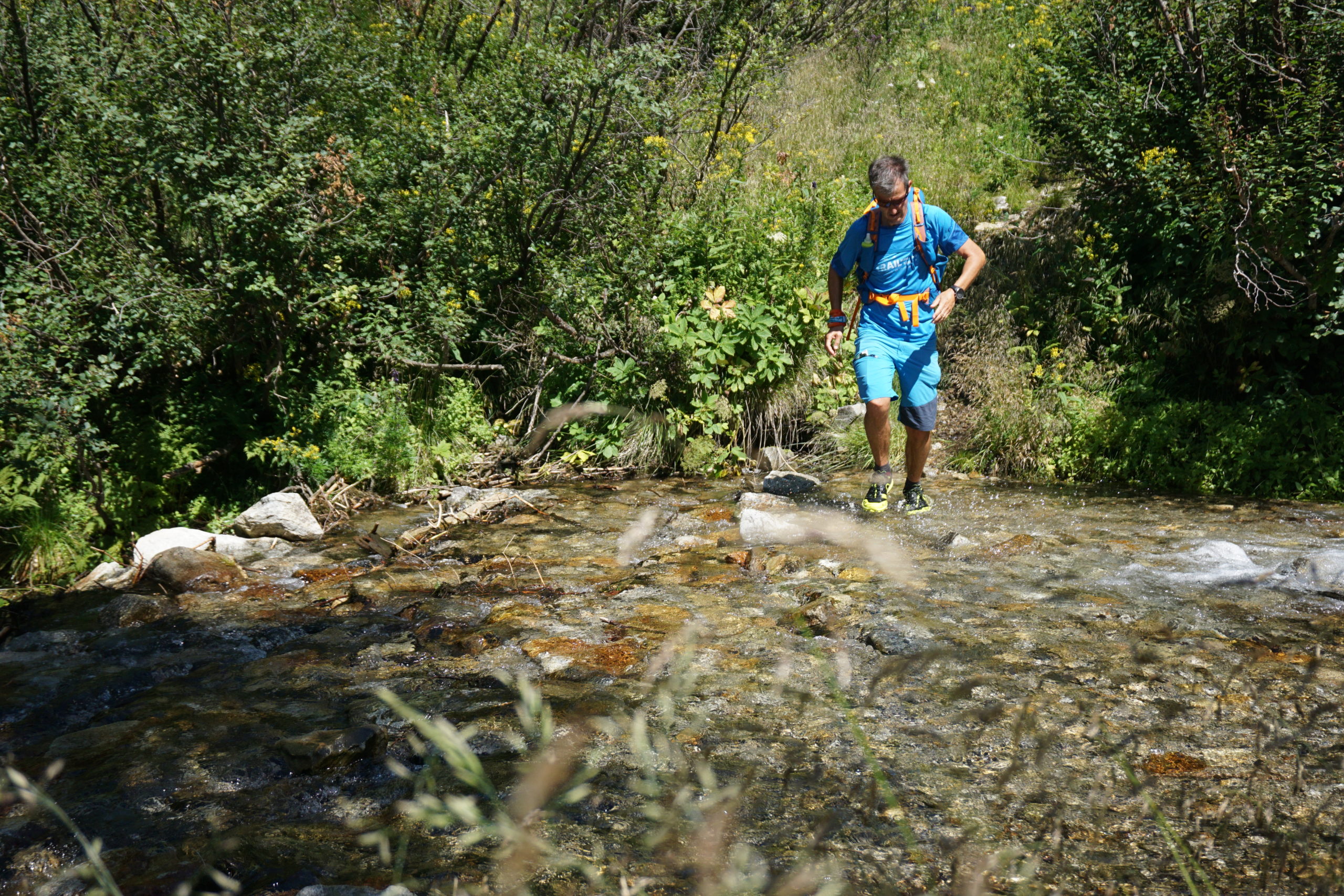
Trailrunning at the Nockberge-Trail © www.trailrunning-szene.at
Equipment list:
Per participant must carry:
• Trail running shoes with a treaded sole, suitable for running in alpine terrain
• Rainwear Overtrousers as rain protection (min. waterproof rain jacket 10.000ml water column)
• Warm clothing (top and long pants or leg warmers) as an insulating mid-layer under the overwear (for bad weather, which can start unexpectedly in the high mountains). The basic rule here is that no skin should be visible!
• change shirt
• gloves and hat
• Water container with at least 1.5 liters capacity
• Food (gel, bars, small snacks)
• Identity card in waterproof cover
• Emergency equipment (rescue blanket 1x, 1 compress 10×10, 2 bandage packs, 2x gloves, triangular cloth 1x, wound plaster 4x, emergency whistle, blister plaster)
• running backpack
• charged cell phone
• Headlamp with spare batteries
Also recommended, among other things: Sunscreen, sports glasses, trail running poles, grease cream to prevent chafing.
Author
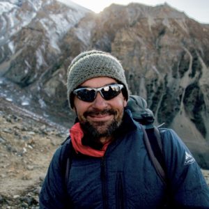
Günter Mussnig
The graduate geographer is one of the founders and managing directors of Trail Angels, which is responsible for the Bookyourtrail.com web platform. As a trekking & outdoor enthusiast, he is one of the fathers of the Alpe-Adria Trail and has been exploring the Nepalese Himalayas for more than 25 years.
Related articles
Travel report autumn-hiking
©Trail AngelsLong-distance hiking in autumn Panorama Trail Southern Alps - autumn hiking can be so beautifulDo you know this too? You can hardly wait for summer after a long winter. And when it actually arrives - perhaps after a rainy spring - it's already over again....
Travel report Amazon of Europe Bike Trail
©Peter RupitschExperience the last great river wilderness in Europe in the border triangle of Croatia, Serbia and Hungary by bike Contents Author Travel Report Offers Who wrote this report for you? Peter Rupitsch from Heiligenblut am Großglockner is one of the most...
BOOKYOURTRAIL.COM
Individual travel planning
Our platform Bookyourtrail® is the first system in the world to combine information, booking and management.
Get involved
Responsible Tourism
Brainstorming
You have often thought about developing a project or business model for sustainable tourism? But you were not sure how to approach it? No problem, we are happy to advise you!
BOOKYOURTRAIL®
Individual travel planning
Our platform Bookyourtrail® is the first system in the world that combines information, booking and management.

Get in touch
Every great journey begins with the first click.
If we could inspire you for sustainable tourism, just get in touch with us. Who knows, maybe something big will come out of this first click together!
FOLLOW US
